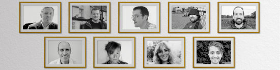
Jonathan Porter | Technical Director
Jonathan is a leading figure in the field of landscape ecology and Geographical Information Systems (GIS). He has contributed greatly to the emerging discipline of Landscape Character Assessment, having developed field survey techniques and pioneered the use of GIS as a tool for landscape planning. As a founding partner of Countryscape, he works closely with landscape ecologists, cartographers and graphic designers, providing consultancy in landscape planning, landscape assessment and GIS. Example work includes designing spatial strategies for planning and development; coordinating national information networks; ecological analysis and habitat Modelling; authoring and editing technical papers and reports; software development, user training and database design. Jonathan is a graduate of Cambridge University, where he studied Natural Sciences, specialising in ecology. Prior to joining Countryscape, he carried out research with The University of Reading and Imperial College at Wye, including researching the link between landscape character and biodiversity, and the development of a habitat creation model for targeting agri-environment schemes.
Paul Mahony | Creative Director
Paul has an extensive track record in communications and marketing, business development and knowledge exchange within both the public and private sectors, focusing on the environment and sustainable tourism. He has developed and managed communications strategies, information platforms and knowledge networks for organisations including the UK Department for Environment, Food & Rural Affairs (Defra), Natural England and the Centre for Ecology & Hydrology (CEH), amongst others. He has also led numerous projects within the tourism sector (including economic development activities), working with Scottish Natural Heritage, Cadw, National Trust and other major operators within the UK. Paul is a member of CharityComms, through which he provides advice to social enterprises. He currently manages the Oppla Secretariat on behalf of EU FP7 projects OPERAs and OpenNESS.
Jemma Simpson | Landscape Analyst
Jemma is a highly qualified landscape analyst; her academic background includes an ESRC CASE award PhD at the Centre for Urban and Regional Ecology (The University of Manchester), in collaboration with Salford City Council. This work explored environmental sustainability and its link with landscape, land use economics and community values. Jemma has a wealth of expertise in understanding landscape and she enjoys using these skills to help people to understand their landscape, celebrating it in ways they didn’t know they could. That could be through landscape characterisation and realising what is special or unique about their area, or understanding the goods and services, or nature based solutions provided by a landscape so it can be managed more sustainably and productively. Jemma believes that all landscapes are special and cherished by the people who live, work and play in them and that landscape is vital for people’s wellbeing, health and happiness. Jemma appreciates how GIS and mapping can bring a range of disparate information together to create a clear picture of a place, how it works and interacts. Jemma helped to prepare the Talking About Our Place Toolkit for SNH and the Ecosystem Approach Handbook with Natural England. These are both valuable tools for helping people to discover and value landscapes and place.
Ivan Gajos | Graphic Designer
Ivan is a highly respected art director and photographer who has worked for a number of international design agencies in both the UK and Australia. His expertise encompasses a variety of contemporary and classic styles, though he is perhaps best known for his clean and functional approach to graphic design, the results of which have been applauded by clients such as the Countryside Agency, IBM, Guinness and American Express, to name a few. Ivan has experience of teaching graphic design software and techniques at a professional level, and continues to gain a reputation as an expert in design communications, applying solid creative principles to an ever-expanding repertoire of media.
Michael Shaw | Web Developer
Michael has over 20 years experience in design communications, working extensively with both print and web-based media. During this time he has gained expertise in a range of commercial design techniques, including desktop publishing and typography, website design and build, digital mapping, cartography and multi-media applications (including interactive maps and Adobe Flash animation). Example work includes the production of leaflets, reports, websites, maps and other media for government agencies, local authorities and private businesses. Prior to joining Countryscape, Michael developed advertising tools, logos and promotional literature for clients such as Rolls Royce, Sainsbury’s and the Cooperative Wholesale Society.
Matthew Brown | Graphic Designer
Matthew is an acclaimed creative designer with proven expertise in communications media. He has a wealth of experience in the commercial sector, developing brand identities, advertising tools and promotional literature for a variety of blue chip clients. He is particularly skilled at conceptual design and is able to translate the most complex messages into clear and meaningful visual form. Example work includes development of national brand identities; production of public and professional print media; icon design for maps and websites; creation of workshop tools and large format display materials. Furthermore, his expertise extends to freehand sketching, illustration and visualisation, which he often applies in the context of community planning and involvement.
James Atkinson | Communications Manager
James has a strong background in communications. His experience includes securing local, sector and national media coverage, organising events, producing online content and engaging audiences at all levels - from the general public to senior politicians. He studied Economics and Politics at the University of Sheffield before working in the renewable energy and charity sectors. James now helps to coordinate the communication, dissemination and exploitation activities of several major EU-funded programmes, as well as managing several visitor-engagement projects in the tourism sector. James has helped raise the profile of organisations, projects and campaigns through both traditional and new media and he is skilled at developing website content, blogs, social media accounts, podcasts and video content.
Naomi Popple | Projects Manager
Naomi is a project manager, specialising in EU-funded research projects. She has worked predominantly in the Higher Education sector, most recently on knowledge exchange and small business support programmes. Naomi is a member of APM and enjoys learning about new developments and best practice in project management. She is passionate about nature and all things outdoorsy.
Cara O'Donnell | Designer
Cara is a designer and illustrator with a background in art and management. Before joining Countryscape, Cara worked as a freelance designer creating brand identities for both national and international clients. Since joining Countryscape, Cara has extended her skillset to become a multidisciplinary designer working on various EU projects producing content for both web and print, such as reports, web design and social media content.


. NASA.")


